leaves the Wyrley and Essington Canal at Catshill Junction and runs to Hay Head at Longwood Junction and then along the Rushall Canal to its junction with the Tame Valley Canal.
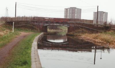
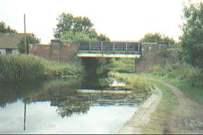
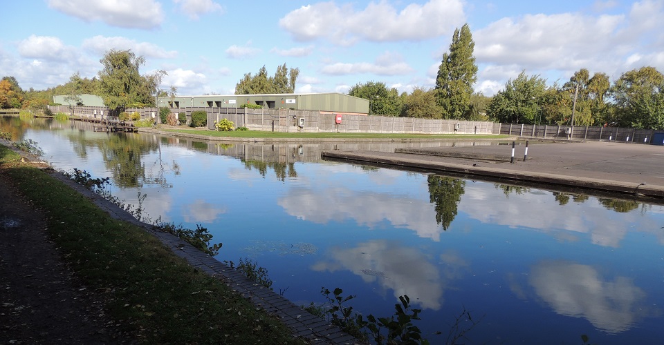
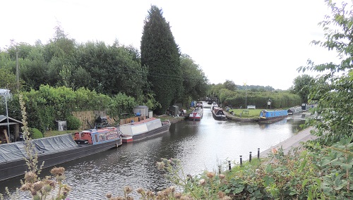
 DR020 Catshill Junction Bridge.
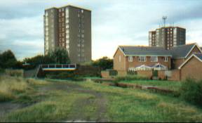
 In the right foreground is the toll halt at the start of the branch.
location - https://www.openstreetmap.org/?mlat=52.64097&mlon=-1.92797#map=18/52.64097/-1.92797
Taken looking North.
Access via towpath
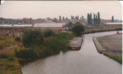 DR030 Toll halt This
divided the canal into two halfs with a centeral island.
In this 1982 picture the left hand route is already
overgrown through lack of use.
DR030 Toll halt This
divided the canal into two halfs with a centeral island.
In this 1982 picture the left hand route is already
overgrown through lack of use.¼
furlongs from Catshill Junction
https://www.openstreetmap.org/?mlat=52.64060&mlon=-1.92820#map=18/52.64060/-1.92819
Taken from Catshill Junction Bridge footbridge looking South.
Access via towpath
 DR040 Clayhanger
Bridge (old)
DR040 Clayhanger
Bridge (old)This 1993 view taken just before rebuilding of the bridge
1½ furlongs from Catshill
Junction
https://www.openstreetmap.org/?mlat=52.63951&mlon=-1.93121#map=18/52.63951/-1.93121
Left - Taken looking West toward Brownhills.
Right - Taken looking east toward Walsall Wood.
Access via Clayhanger Road
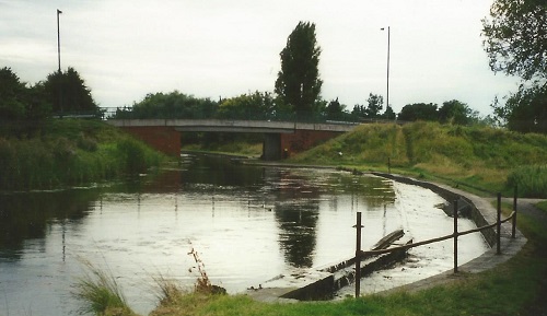 DR040
Clayhanger Bridge The new bridge is dated 1994.
The overflow in right foreground ensures that the
waterlevel of the canal does nor rise too high.
DR040
Clayhanger Bridge The new bridge is dated 1994.
The overflow in right foreground ensures that the
waterlevel of the canal does nor rise too high.1½ furlongs from Catshill Junction
https://www.openstreetmap.org/?mlat=52.63951&mlon=-1.93121#map=18/52.63951/-1.93121
Taken looking West.
Access via Clayhanger Road
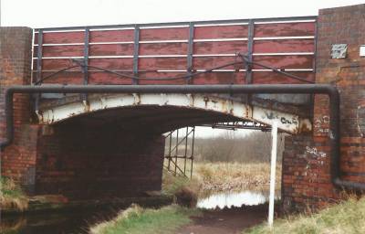
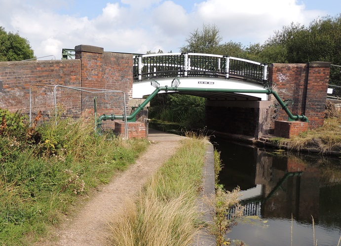
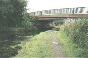
 DR060
Blackcock Bridge (old span)
DR060
Blackcock Bridge (old span)This section of the canal does pass through an area of some subsidence resulting from the old workings of the Walsall Wood Collery. The roof of the "Black Cock Inn" pub (in the distance, on the right) is level with the towpath - once the front door step was level with the canal - so an urban myth says!
7 furlongs from Catshill Junction
https://www.openstreetmap.org/?mlat=52.63080&mlon=-1.93543#map=18/52.63080/-1.93543
what3words /// The simplest way to talk about location
Photos taken - 1/12/2020.
Access via Camden Street/Green Lane/Hall Lane.
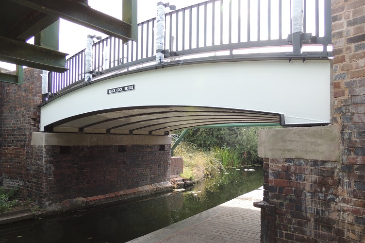
 DR060
Blackcock Bridge - new span 2022
DR060
Blackcock Bridge - new span 2022Lefthand photo looking south
righthand photo looking north
7 furlongs from Catshill Junction
OpenStreetMap
what3words /// The simplest way to talk about location
Photos taken - 27/8/2022.
Access via Camden Street/Green Lane/Hall Lane.
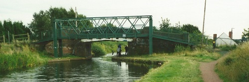
 DR070 Walsall
Wood Bridge
DR070 Walsall
Wood Bridge 1 mile and 2½
furlongs from Catshill Junction
https://www.openstreetmap.org/?mlat=52.62489&mlon=-1.93441#map=18/52.62489/-1.93441
Left photo taken looking South.
Right photo taken looking North. Photo taken - 7/6/2022
Access via Walsall Road/High Street via steps.
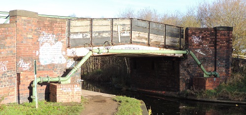
 DR080 Hollanders
Bridge (old span)
DR080 Hollanders
Bridge (old span)1 mile and 3¾
furlongs from Catshill Junction
https://www.openstreetmap.org/?mlat=52.62292&mlon=-1.93556#map=18/52.62292/-1.93556
what3words /// The simplest way to talk about location
Taken looking South.
Access to the towpath from the bridge - Bridge open to pedestrians only - Road access from Boatmans Lane or East end of Queen Street.
 DR080 Hollanders Bridge (new span)
1 mile and 3¾ furlongs from Catshill Junction
https://www.openstreetmap.org/?mlat=52.62292&mlon=-1.93556#map=18/52.62292/-1.93556
what3words /// The simplest way to talk about location
Taken looking South. Photo taken - 7/6/2022
Access to the towpath from the bridge - Bridge open to pedestrians only - Road access from Boatmans Lane or East end of Queen Street.
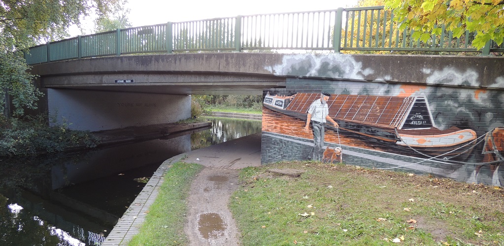 DR090
Latham's Bridge dated 1982.
DR090
Latham's Bridge dated 1982.1 mile and 4¼
furlongs from Catshill Junction
The new mural from October 2022
Taken looking West.
Access from Boatmans Lane
https://www.openstreetmap.org/?mlat=52.6219&mlon=-1.9360#map=16/52.6219/-1.9360
 DR100 Aldridge Marina
- Brickyard Road, Aldridge, Walsall, WS9
DR100 Aldridge Marina
- Brickyard Road, Aldridge, Walsall, WS91
mile and 6½ furlongs from Catshill Junction
https://www.openstreetmap.org/?mlat=52.61833&mlon=-1.93431#map=17/52.61833/-1.93431
what3words /// The simplest way to talk about location
Taken looking West - 8/10/2022.
Access from Brickyard Road and via Northywood Bridge
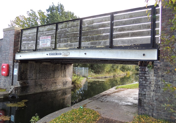 DR110 Northywood
Bridge - also known as Homers Bridge
DR110 Northywood
Bridge - also known as Homers Bridge1 mile and 6¾
furlongs from Catshill Junction
https://www.openstreetmap.org/?mlat=52.61794&mlon=-1.93465#map=17/52.61794/-1.93464
what3words /// The simplest way to talk about location
Taken looking south - 8/10/2022.
Access from Brickyard Road and footpath from Stubbers Green Road
2 miles and 1¼ furlongs from Catshill Junction
https://www.openstreetmap.org/?mlat=52.61411&mlon=-1.93126#map=17/52.61411/-1.93126
2 miles and 4½ furlongs from Catshill Junction
https://www.openstreetmap.org/?mlat=52.60909&mlon=-1.92781#map=17/52.60910/-1.92782
2 miles and 6 furlongs from
Catshill Junction
https://www.openstreetmap.org/?mlat=52.60634&mlon=-1.92777#map=17/52.60634/-1.92777
3 miles from Catshill Junction
https://www.openstreetmap.org/?mlat=52.60574&mlon=-1.93290#map=17/52.60575/-1.93290
3
miles and 1 furlong from Catshill Junction
https://www.openstreetmap.org/?mlat=52.60388&mlon=-1.93435#map=17/52.60388/-1.93434
3
miles and 2½ furlongs from Catshill Junction
https://www.openstreetmap.org/?mlat=52.6044&mlon=-1.9368#map=16/52.6044/-1.9368
3 miles and 6¾ furlongs from
Catshill Junction
https://www.openstreetmap.org/?mlat=52.60703&mlon=-1.94888#map=17/52.60703/-1.94888
4 miles and ¼ furlongs from
Catshill Junction
https://www.openstreetmap.org/?mlat=52.60571&mlon=-1.95265#map=17/52.60572/-1.95266
4 miles and 2¼ furlongs from
Catshill Junction
https://www.openstreetmap.org/?mlat=52.60270&mlon=-1.95295#map=17/52.60271/-1.95296
4
miles and 2¼ furlongs from Catshill Junction
https://www.openstreetmap.org/?mlat=52.60249&mlon=-1.95351#map=17/52.60250/-1.95350
4 miles and 2¾
furlongs from Catshill Junction
https://www.openstreetmap.org/?mlat=52.60154&mlon=-1.95389#map=17/52.60155/-1.95389
4
miles and 4 furlongs from Catshill
Junction
https://www.openstreetmap.org/?mlat=52.59984&mlon=-1.95304#map=17/52.59984/-1.95305
 DR240 Riddian Bridge
carries a farm lane over the canal
DR240 Riddian Bridge
carries a farm lane over the canal4 miles and 6½
furlongs from Catshill Junction
https://www.openstreetmap.org/?mlat=52.59606&mlon=-1.94854#map=17/52.59606/-1.94854
Taken looking north-west. Photo taken - 29/7/2021
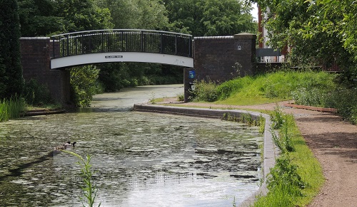
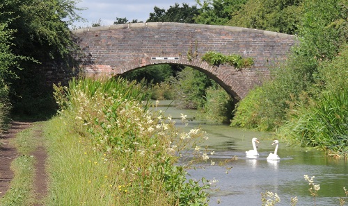
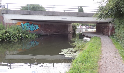 DR250 Longwood Bridge
carries Aldridge Road over the canal.
DR250 Longwood Bridge
carries Aldridge Road over the canal.5 miles and 2¼
furlongs from Catshill Junction
https://www.openstreetmap.org/?mlat=52.59092&mlon=-1.94227#map=17/52.59092/-1.94228
Taken looking south. Photo taken - 29/7/2021
 DR260 Longwood
Junction. The meeting of the Daw End Branch with the Hay
Head arm and the Rushall Canal (to the right).
DR260 Longwood
Junction. The meeting of the Daw End Branch with the Hay
Head arm and the Rushall Canal (to the right).The Rushall Canal that runs 2 miles and 6½ furlongs down 9 locks to meet the the Tame Vally Canal under the M6/M5 motorway interchange at Ray Hall, Walsall.
5 miles and 2¾ furlongs from Catshill
Junction
https://www.openstreetmap.org/?mlat=52.59047&mlon=-1.94235#map=17/52.59047/-1.94234
Taken looking south. Photo taken - 29/7/2021
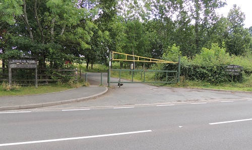 DR270 Hay Head Wood (nature
reserve) in Longwood Lane includes the remains of the
canal.
DR270 Hay Head Wood (nature
reserve) in Longwood Lane includes the remains of the
canal. There is little sign of the removed Hay Head Bridge in Longwood Lane at https://www.openstreetmap.org/?mlat=52.58883&mlon=-1.94099#map=17/52.58882/-1.94099
Taken looking east. Photo taken - 29/7/2021
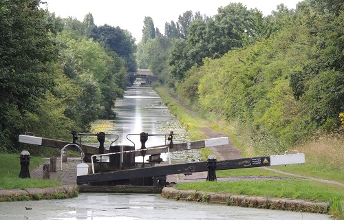
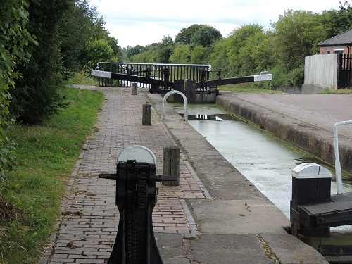 DR300 Lock 1 first of
"the Mosses Two"
DR300 Lock 1 first of
"the Mosses Two"Location - https://www.openstreetmap.org/?mlat=52.58949&mlon=-1.94280#map=17/52.58949/-1.94282
Taken looking south. Photo taken - 29/7/2021
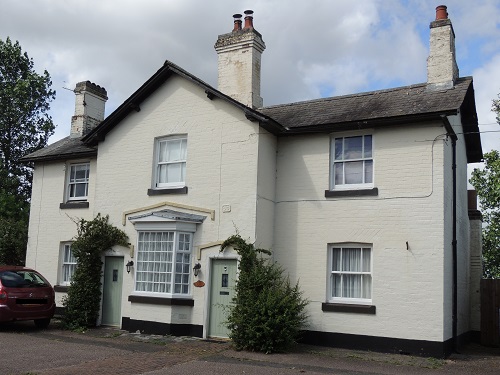 DR310 Canal cottage -
BCN number 93
DR310 Canal cottage -
BCN number 93Location - https://www.openstreetmap.org/?mlat=52.58949&mlon=-1.94299#map=18/52.58949/-1.94299
Taken looking west. Photo taken - 29/7/2021
 DR320 Lock 2 –
second of "the Mosses Two" with Moat Bridge in
the distance.
DR320 Lock 2 –
second of "the Mosses Two" with Moat Bridge in
the distance.Location - https://www.openstreetmap.org/?mlat=52.58832&mlon=-1.94331#map=17/52.58832/-1.94330
Taken looking south. Photo taken - 29/7/2021