| Virtual
Walks -5 From Ogley Junction (or Anglesey
Junction) to Huddlesford Junction Wyrley and Essington Canal |
||
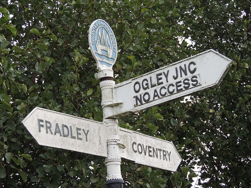
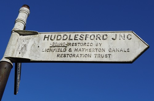 The BCNS sign pointing towards
Huddlesford reads "(being) restored by Lichfield and
Hatherton Canals Restoration Trust" The BCNS sign pointing towards
Huddlesford reads "(being) restored by Lichfield and
Hatherton Canals Restoration Trust"The word "being" is on a separate plate that can be removed when the line is reopened ! This shows the confidence that the canal will be passable again in the not too distant future. Visit the Lichfield & Hatherton Canals Restoration Trust web site to find out about the Trust that was formed in 1988 and is a registered charity. It campaigns for the restoration of the "Lichfield Canal" (as the closed section of the W&E between Ogley and Huddlesford is now called) and also the Hatherton Canal through the Cannock / A5 area. It promotes the restoration as public amenities for boating, angling, walking, cycling etc. and raises funds to carry out physical restoration work. |
||
| Distance in italics is for the
original canal measured from Wolverhampton or Ogley Junction. Miles and
furlongs - don't have a clue? Those were the measurements
when the canals were built. In metric a mile is 1.61
kilometres. A furlong is an eigth of a mile or 200 metres. The other distances used are for the route when restored and realigned in places by LHCRT. |
||
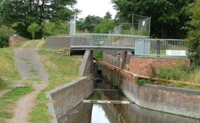
  L010 - Ogley
Junction (or Anglesey Junction) 16
miles 3 furlongs from Horseley Fields Junction,
Wolverhampton. L010 - Ogley
Junction (or Anglesey Junction) 16
miles 3 furlongs from Horseley Fields Junction,
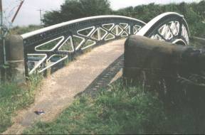
Wolverhampton.Anglesey Junction Foot Bridge (2000
& 1982) https://www.openstreetmap.org/?mlat=52.65157&mlon=-1.91632#map=18/52.65158/-1.91632 Taken looking East, toward where the first of 30 locks that drop to Huddlesford Junction. Access via Lichfield Road, Brownhills. |
||
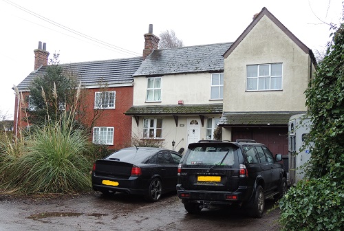
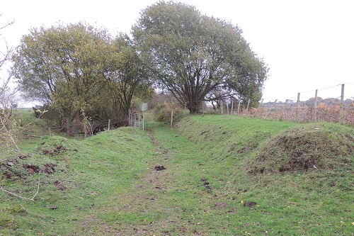
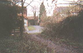
  Marina at the head of the (currently
disused) locks down toward Huddlesford Junction. Lock
Cottage, 271-272 Lichfield Road is visible between the
trees. Marina at the head of the (currently
disused) locks down toward Huddlesford Junction. Lock
Cottage, 271-272 Lichfield Road is visible between the
trees.Taken looking East from Ogley
Junction Bridge. |
||
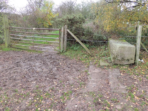
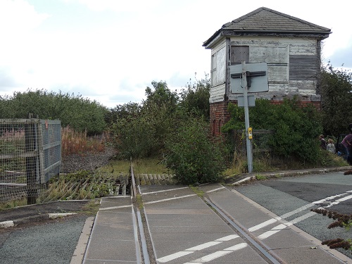
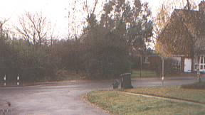
 L010 - BCN
Cottages BCN 272 & 271. L010 - BCN
Cottages BCN 272 & 271.Just east of Ogley Junction (or Anglesey Junction) Foot Bridge at the start of the Lichfield Canal (to be renovated). Taken looking south. |
||
| L030 - Ogley 1st.
Flight Lock 1 0 miles 117 yards or 0.11 Km from Ogley
Junction (at the end of the marina, buried under the
gardens of the lock cottages.) Drop of 9ft 6in (2.9m). L040 - Ogley
1st. Flight Lock 2 0 miles 228 yards or 0.21 Km from
Ogley Junction (back of Grassmere Gardens). L050 - Ogley 1st. Flight Lock 3
0 miles 335 yards or 0.31 Km from Ogley Junction. L060 - Ogley 1st. Flight Lock 4
0 miles 459 yards or 0.42 Km from Ogley Junction. |
||
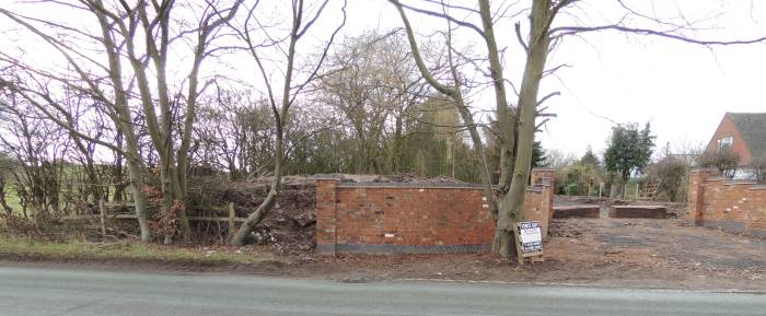  L080 - Barracks
Lane Bridge (Original) - Barracks
Lane, off Lichfield Road. L080 - Barracks
Lane Bridge (Original) - Barracks
Lane, off Lichfield Road. 0 miles 3 furlongs from
Ogley Junction. Where the humped back bridge would have been if it had not been removed to flatten the road over it. Looking West from Barracks Lane near the bottom of the flight of locks down from Ogley Junction. Photo on left looking West from
Barracks Lane - Mar 2003 Photo on right looking West from
Barracks Lane - Feb 2013 L070 - Ogley 1st. Flight Lock 5
0 miles 603 yards or 0.55 Km from Ogley Junction. |
||
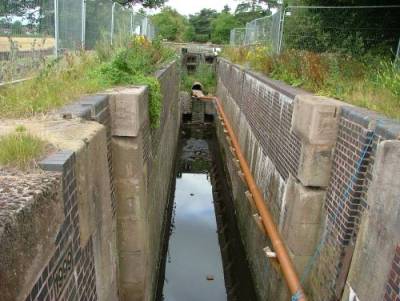
 L090 - Ogley
1st. Flight Lock 6, 0 miles 3¼ furlongs from Ogley
Junction. L090 - Ogley
1st. Flight Lock 6, 0 miles 3¼ furlongs from Ogley
Junction.Drop of 8ft 2ins (2.5m). Taken looking west along the
line of the canal - lock 6 by the gate. Note :- these photos do not imply right of access or safe walking! |
||
| L100 - New Barracks Lane Bridge 0 miles 742 yards or 0.68 Km from Ogley Junction - Proposed new bridge on realigned Barracks Lane. ???? | ||
 |
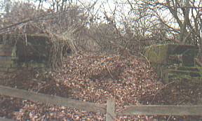
L110 - (Original)
Ogley 1st. Flight Lock 7, which will be retained as
narrows NEW Drop of 0ft 0ins (0.0m). Taken looking east along
the line of the canal - site of lock 7. Note :- these photos do not imply right of access or safe walking! |
 |
The photo on the left is of the westerly end of the lock, that on the right is of the lower easterly end (taken from what is now the fast lane of the M6Toll motorway!). (Original) Ogley 1st. Flight Lock 8, 0
miles 5¼ furlongs from Ogley Junction - which will
be buried. Note :- these photos do not imply right of access or safe walking! ------ (More Photos in my Flickr album - Lichfield Canal) |
||
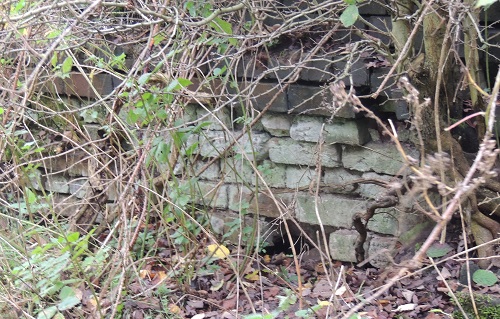
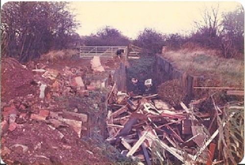
 L120
- (Original) Lock No.8 reverting to nature in
April 2003 and about to be lost to cater for the M6Toll
motorway. The photo is a repeat of that above. L120
- (Original) Lock No.8 reverting to nature in
April 2003 and about to be lost to cater for the M6Toll
motorway. The photo is a repeat of that above.The lock lowered the water level from the higher Brownhills side. To keep the canal high enough to pass over the new motorway the level will not drop until after crossing the new road. This original lock will be lost under a short embankment leading to the aqueduct that is currently being built. A new lock 8 will be constructed on the far side of the aqueduct. https://www.openstreetmap.org/?mlat=52.65494&mlon=-1.90253#map=18/52.65494/-1.90253 Note :- these photos do not imply right of access or safe walking! |
||
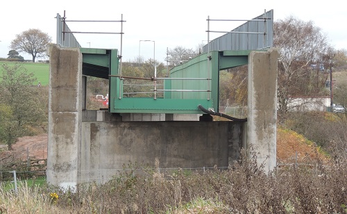
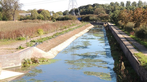
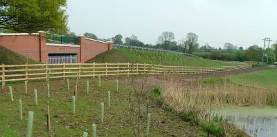
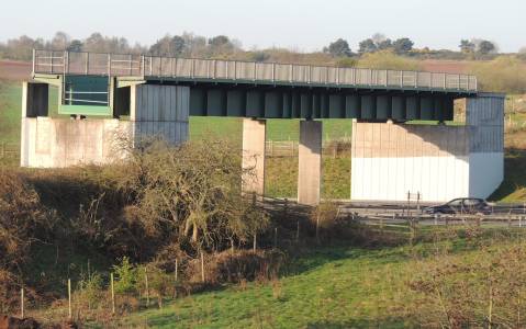 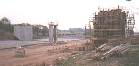 L130 -
BNRR - M6Toll Motorway ----- The David Suchet Aqueduct L130 -
BNRR - M6Toll Motorway ----- The David Suchet AqueductDue to building of Britain's first privately owned toll charging motorway a crossing has been needed to secure the route required for the re-opening of the Lichfield section of the Wyrley and Essington Canal. The crossing was built with government support, a large donation from The Manifold Trust, the work of Lichfield and Hatherton Canals Restoration Trust and the co-operation of the motorway's builders (CAMBBA). The motorway is operated by MEL (Midland Expressway Ltd.). The canal will be held within a steel aqueduct constructed by Rowecord Engineering Ltd. of Newport, South Wales. The photograph (above left) of April 2003 shows the concrete structures with the soon to disappear lock 8 just out of the picture to the right. It aqueduct was placed on the concrete structures over the weekend of 16-17/8/2003. The photograph (right) of April 2015 shows the 45 by 8 metre steel aqueduct. David Suchet Aqueduct (start) 0 miles 1202 yards or 1.10
Km from Ogley Junction https://www.openstreetmap.org/?mlat=52.65516&mlon=-1.90155#map=18/52.65516/-1.90155 |
||
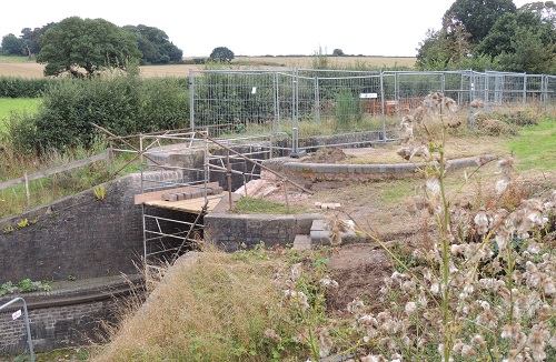
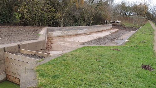
 L150 - The
"MEGALOCK" ---- In a change to the original
plan, the installation of two new locks to replace Locks
7 and 8 will be combined into one very deep lock. L150 - The
"MEGALOCK" ---- In a change to the original
plan, the installation of two new locks to replace Locks
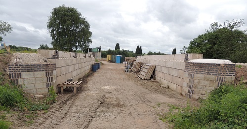
7 and 8 will be combined into one very deep lock.(NEW) Ogley 1st. Flight Lock 8 "A new deep lock is required near the end of the Aqueduct to allow boats to rise from the existing canal channel to connect with the Aqueduct. A drop of about 5 metres is required. To avoid loss of water it will be back-filled by electric pump." ( from LHCRT ) Taken looking east from the site of lock 8. https://www.openstreetmap.org/?mlat=52.65527&mlon=-1.90116#map=17/52.65527/-1.90117 |
||
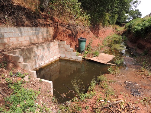
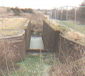
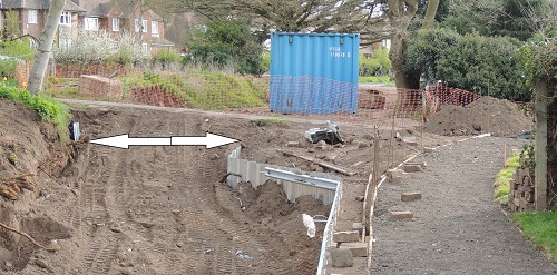
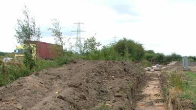
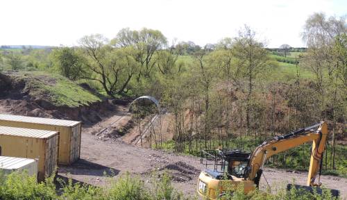  L160 -
Crane Brook Culvert L160 -
Crane Brook CulvertFrom LHCRT - "On Friday, 6th March 2015 Lichfield MP, Michael Fabricant, formally cut the first sod for the work which will see the reinstatement of a culvert and small aqueduct which was demolished when the M6 Toll motorway was built. This structure will enable the Lichfield Canal Trust to reinstate the canal right up to the aqueduct which the Trust had to install before the motorway opened to traffic in 2003. In the immediate? future there will only be a walking route from the Boat Inn to Barracks Lane but this will open up the canal route to the general public. This has been made possible because the Trust managed to attract a substantial funding grant at the turn of the year to open up derelict canal land linking Lichfield and Brownhills." The culvert will be 43 metres long. The level of the old canal bed can be seen on the left of the photo. Photo on the left -
from A5 Waling Street looking South - 27/4/2015 |
||
| No longer required - see the "MEGALOCK"
above ...... (NEW) Ogley 1st. Flight Lock 7 0 miles
1391 yards or 1.27 Km from Ogley Junction |
||
| Cranebrook Quarry Marina ? From
LHCRT
- March 2015 ---- |
||
| No longer required - see the "MEGALOCK"
above ...... (NEW) Ogley 1st. Flight Lock 8 1 miles
123 yards or 1.72 Km from Ogley Junction |
||
 L190 - ((NEW)
Ogley 2nd. Flight Lock 9A 1 miles 581 yards or 2.14 Km
from Ogley Junction. L190 - ((NEW)
Ogley 2nd. Flight Lock 9A 1 miles 581 yards or 2.14 Km
from Ogley Junction.New Lock will have drop of 4ft 7in (1.4m). Photo taken 16/7/2018 from the site of lock 9a looking east with "The Boat" on the right and the A461 Walsall Road straight ahead. https://www.openstreetmap.org/?mlat=52.65214&mlon=-1.89021#map=18/52.65214/-1.89021 |
||
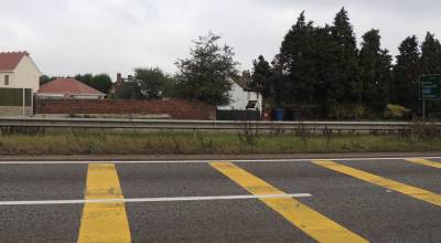
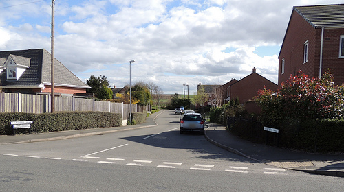
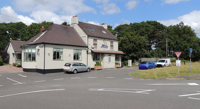 L200 - Walsall Road (A461, Summerhill, Nr
Muckley Corner) L200 - Walsall Road (A461, Summerhill, Nr
Muckley Corner)(Entry updated 31/7/2015) The
canal crossed the road at the side of the Boat Inn
public house (to the right of this photo). The long dry canal is currently being developed as a Heritage Towpath Trail. Access to the canal walk is to the right of the the pub by the white pillar and gate. Boat Inn Pipe Bridge - start 1 miles 616 yards or 2.17 Km from Ogley Junction Boat Inn Culvert - start 1 miles 616 yards or 2.17 Km from Ogley Junction Boat Inn Culvert - finish 1 miles 686 yards or 2.24 Km from Ogley Junction (Photograph - 30 July 2015) - (More Photos in my Flickr album - Crane Brook and the David Suchet Aqueduct) |
||
| Boat Lane The canal followed the line of the lane on its northern side. | ||
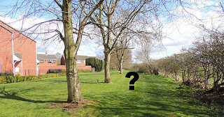
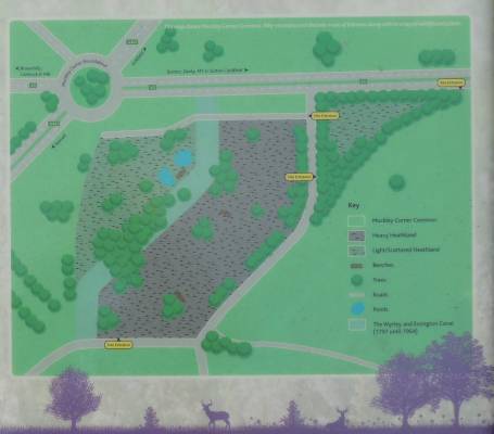 Muckley
Corner Common Muckley
Corner Common"Muckley
Corner Common, or Wall Butts Common as it is officially
known, is an area of former heathland lying south of the
A5 Watling Street at Muckley Corner, between Wall and
Brownhills, approximately 7.5 hectares in size. The site
is divided into two by Cranebrook Lane, which extends
from Watling Street towards Stonnall. The Wyrley and
Essington Canal ran through the site from 1797 until its
closure in 1954. The canal was purchased by a private
owner, while the rest of the site is owned by Lichfield
District Council." Photo of the common with canal line going from bottom left to centre top - Aug 2014 |
||
| L230 - (NEW) Ogley
2nd. Flight Lock 9B 1 miles 1514 yards or 2.99 Km from
Ogley Junction, New Lock will have drop of 4ft 3in (1.3m). |
||
 L240
- Watling Street (A5) crossing - (east
from Muckley Corner) L240
- Watling Street (A5) crossing - (east
from Muckley Corner)A5 culvert - start 1 miles 1584 yards or 3.06 Km from Ogley Junction A5 culvert - finish 1 miles 1636 yards or 3.11 Km from Ogley Junction Danks Cottage (now the white house - "Wharf House") and wharf was the original crossing point - the new crossing will be a little to the right. Photo from Muckley Corner Common looking north across A5 -
Sept 2014 |
||
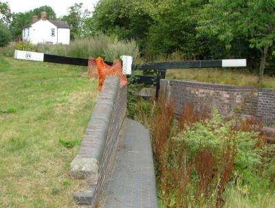
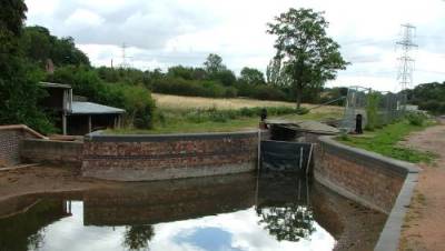
| L260 - Ogley 2nd.
Flight Lock 9 2 miles 50 yards or 3.25 Km from Ogley
Junction - the proposed new route will by-pass this lock. Drop of 0ft 0in (0.0m). L270 - Ogley
2nd. Flight Lock 10 2 miles 253 yards or 3.45 Km from
Ogley Junction - before bridge. |
||
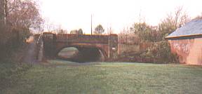
| L290 - Muckley Corner
Bridge Walsall Road (A461 -
north from Muckley Corner) The canal passed under the
bridge at the junction of Walsall Road and
Wall Lane. L280 - Ogley 2nd.
Flight Lock 11 2 miles 458 yards or 3.64 Km from Ogley
Junction - adjoining bridge.
The infilling under the bridge has been removed and steps layed down to towpath level. (Photo looking North-West across A461 toward Coppice Lane - Mar 2009) https://www.openstreetmap.org/?mlat=52.66040&mlon=-1.87597#map=17/52.66040/-1.87597 |
||
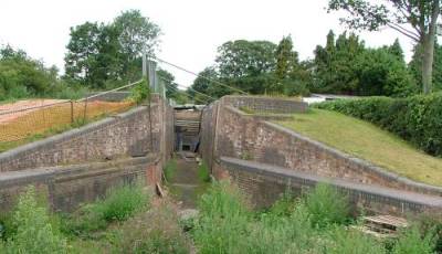
 |
L300 -
Coppice Lane Lock No.12 Ogley 2nd. Flight Lock 12 2 miles 669 yards or 3.83 Km from Ogley Junction with a rise of 9ft 6in (2.9m). https://www.openstreetmap.org/?mlat=52.66195&mlon=-1.87707#map=18/52.66195/-1.87707 Photo on the left - Looking north to
Coppice Lane. - Nov 1981 Photo on the right - Looking south from Coppice Lane. - Nov 2016 |
 |
 L310 -
Coppice Lane Bridge L310 -
Coppice Lane BridgeCoppice Lane Bridge 2 miles 686 yards or 3.85 Km from Ogley Junction The large pipe viewed from the road shows where the canal would pass under a road bridge. Coppice Lane looking south. - Nov 2016 |
||
 Walsall
Road (A461 - Pipe Hill) --- The canal passes at
the rear of the South Staffs Water Works pumping station Walsall
Road (A461 - Pipe Hill) --- The canal passes at
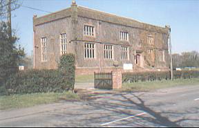
the rear of the South Staffs Water Works pumping station and on to Pipe Hill Wharf (or Walsall Road Wharf) - 19 miles 0 furlongs from Horseley Fields Junction, Wolverhampton - that is at the Walsall Road bridges. Walsall Road crosses a triple bridge with arches from south to north - canal - wharf access & farm track - South Staffordshire Railway to Lichfield South Staffs Water Works pumping station at https://www.openstreetmap.org/?mlat=52.66479&mlon=-1.87277#map=18/52.66479/-1.87277 |
||
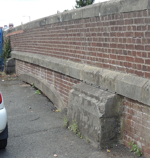
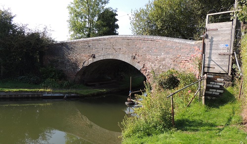
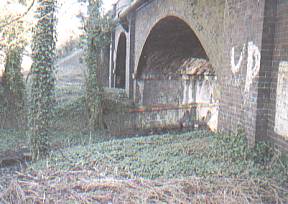  L320 - Walsall
Road L320 - Walsall
Road (A461 - Pipe Hill) --- Walsall Road crosses a triple bridge with arches from south to north - canal - farm track - railway. The photo on the left was taken from the west side of the bridges, looking north. The photo on the left was taken from the east side of the bridges looking back to the west. This photo (taken in March 2003) shows the straight metal beams of the railway arch that will shortly be replaced. Also shown are the brick sides of the canal and the size of the trees that have grown in the canal bed since closure. Pipehill Bridge 2 miles 1602 yards or 4.68 Km from Ogley Junction https://www.openstreetmap.org/?mlat=52.66739&mlon=-1.86872#map=17/52.66739/-1.86872 |
||
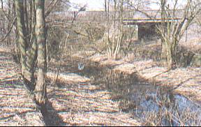
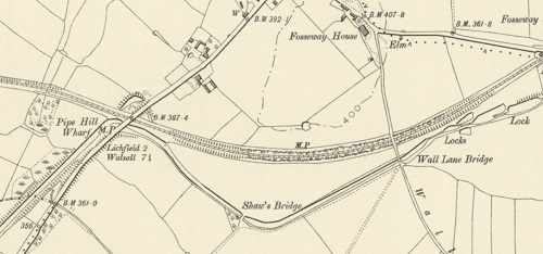 L320 - Smith's
Bridge or Shaw's Bridge (farm track) L320 - Smith's
Bridge or Shaw's Bridge (farm track)Map from National
Library of Scotland © |
||
 Wall Lane
Bridge Wall Lane
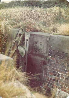
BridgeL330 - Wall Lane Bridge 3 miles 598 yards or 5.38 Km from Ogley Junction L340 - Ogley 3rd. Flight Lock 13 3 miles 704 yards or 5.47 Km from Ogley Junction with a drop of 8ft 6in (2.6m). L350 - Ogley 3rd. Flight Lock 14 3 miles 792 yards or 5.55 Km from Ogley Junction with a drop of 8ft 10in (2.7m). L360 - Ogley 3rd. Flight Lock 15 3 miles 862 yards or 5.62 Km from Ogley Junction with a drop of 9ft 6in (2.9m). L370 - Ogley 3rd. Flight Lock 16 3 miles 915 yards or 5.76 Km from Ogley Junction with a drop of 8ft 10in (2.7m). L380 - Ogley 3rd. Flight Lock 17 3 miles 1126 yards or 5.86 Km from Ogley Junction with a drop of 9ft 2in (2.8m). Map from Lichfield Canal (Restoration) Maps – FREE – Waterway Routes |
||
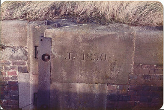 Cornerstone "jly 1850" (photo Nov1981) |
Wall Lane locks
betweenWall Lane and Fossway Lane The photo to the left is probably Lock 15. The photo to the right is probably Lock 17. ------ (More Photos in my Flickr album - Lichfield Canal) |
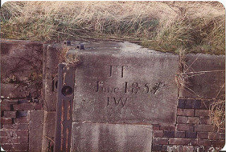 Cornerstone "JT - june 1857 - JW" (photo Nov1981) |
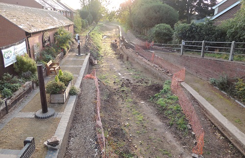
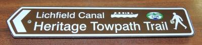 New from the LHCRT in 2014. New from the LHCRT in 2014.
"Over the coming months sections of the Lichfield Canal Towpath will be opened to the public to form the Heritage Towpath Trail. A Brochure and Interactive Map will be issued showing how the Lichfield Canal wraps around the City, including links into the City and other paths, walks, cycle routes etc as well as heritage information." Lookout for signs from here to Huddlesford Junction. |
||
 |
L390 - Fosseway Lane
Bridge and BCN268 cottageOn the left from 1/9/2015 The closed railway a little to the north of the line of the canal. Looking east - toward Huddlesford.On the right from 1/9/2015 The signal box Fosseway Lane crossing point Canal cottage BCN268Fosseway Lane culvert 3 miles 1144 yards or 5.87 Km from Ogley Junction https://www.openstreetmap.org/?mlat=52.66882&mlon=-1.85264#map=18/52.66882/-1.85264 |
 |
  L400 -
Ogley 3rd. Flight Lock 18 (Wood Lock) L400 -
Ogley 3rd. Flight Lock 18 (Wood Lock)To the left - photo of March 2003 taken looking east with the railway line higher up on the left. To the right - photo of 19/9/2021 taken looking south-west Ogley 3rd. Flight Lock 18 3 miles 1302 yards or 6.02
Km from Ogley Junction. |
||
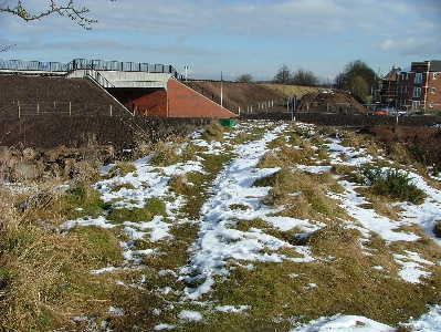
 L420 - Fosseway Heath, Nature Reserve and
Wetlands L420 - Fosseway Heath, Nature Reserve and
WetlandsLichfield Haven - A wide-angle view of the Falkland Road turning pound. to the left - the original route
running north-east. 16/12/2019 - looking south at https://www.openstreetmap.org/?mlat=52.67152&mlon=-1.84158#map=18/52.67152/-1.84159 |
||
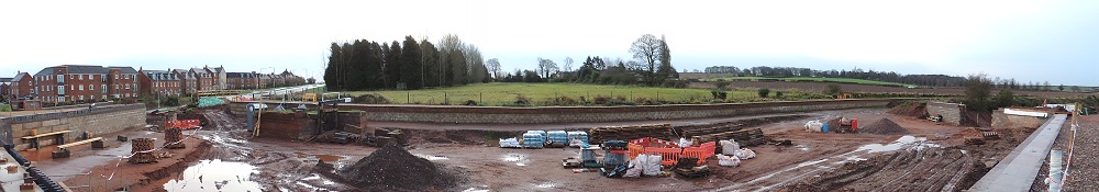
  L420 -
Falkland Road, Sandfields (Lichfield Southern Bypass)
the line of the canal crosses the road and passes between
the railway embankment and the new flats. L420 -
Falkland Road, Sandfields (Lichfield Southern Bypass)
the line of the canal crosses the road and passes between
the railway embankment and the new flats.These photos of February 2010 taken looking east with the railway line higher up on the left crossing the new bridge. The canal bed is on the far right of the photo. On the left are large stone blocks from the canal ( moved due to the road building.) The new road is lower than the canal and not in view.
|
||
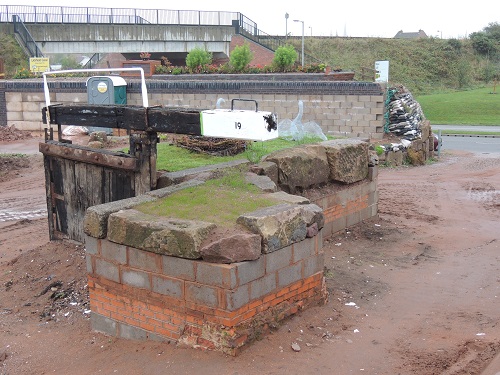 L440 -
Lock 19 - (old) - Railway Turn - Swan Island L440 -
Lock 19 - (old) - Railway Turn - Swan IslandThe original route would have carried on at the top right of the photo. The diverted route will turn sharp right around the new Swan Island and follow Falkland Road (out of the right-hand side of the photo) photo from 15/10/2019 looking north-east at https://www.openstreetmap.org/?mlat=52.67153&mlon=-1.84133#map=18/52.67152/-1.84133 |
||
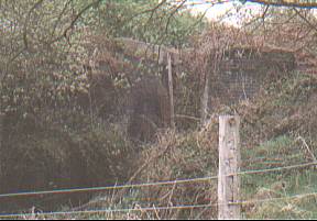
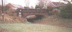
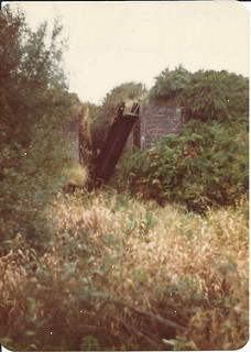 L120 - (Original)
Lock No.8 as it was in October 1981.
L120 - (Original)
Lock No.8 as it was in October 1981.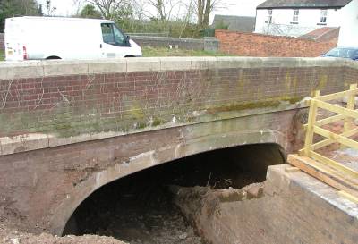 A461 Moat Bank Bridge (Muckley
Corner Bridge)
A461 Moat Bank Bridge (Muckley
Corner Bridge)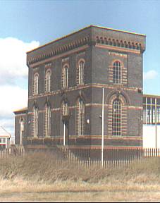
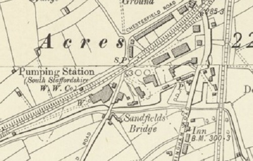
 L460 -
Sandfields Pumping Station on the west side of Chesterfield Road. This March 2003 photo, taken
looking north, looks across the path of the canal in the
foreground. ----- on old route
L460 -
Sandfields Pumping Station on the west side of Chesterfield Road. This March 2003 photo, taken
looking north, looks across the path of the canal in the
foreground. ----- on old route
 L470 -
Chesterfield Road Bridge -
Taken along the line of the canal toward Lichfield with
the houses of Chesterfield Road ahead.
L470 -
Chesterfield Road Bridge -
Taken along the line of the canal toward Lichfield with
the houses of Chesterfield Road ahead. 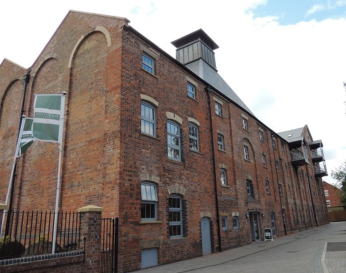
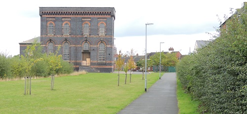
 L480 -
Canal Basin- Wharfs-Brewery "The Maltings"
L480 -
Canal Basin- Wharfs-Brewery "The Maltings" 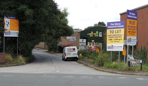
 L500 -
Birmingham Road (A5127) - The canal crossed the
road on the line of the current Essington
Close (and near Wyrley Close). ----- on old route
L500 -
Birmingham Road (A5127) - The canal crossed the
road on the line of the current Essington
Close (and near Wyrley Close). ----- on old route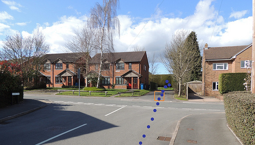
 L530 Lock 22 at
Shortbutts Lane
L530 Lock 22 at
Shortbutts Lane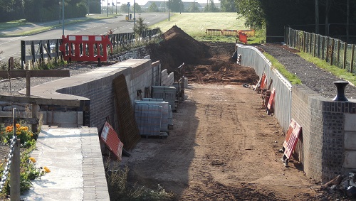 L540 -
Falkland Road (the new A461 southern bypass)
L540 -
Falkland Road (the new A461 southern bypass)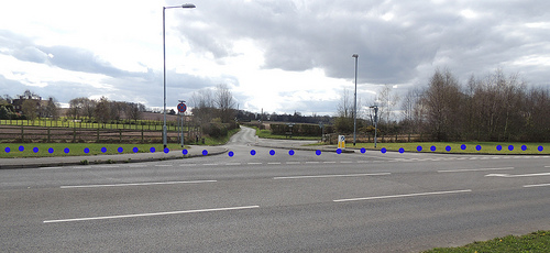 L550 -
Claypit Lane Culvert (or Fosseway Culvert or Clay
Pit Lane Bridge)
L550 -
Claypit Lane Culvert (or Fosseway Culvert or Clay
Pit Lane Bridge) L560 Locks 19/20/21
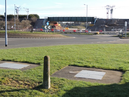 L590 Birmingham
Road Tunnel
L590 Birmingham
Road Tunnel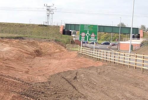 L620 -
Cross-City railway line Tunnel
L620 -
Cross-City railway line Tunnel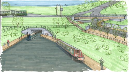 L620 - From the
LHCRT web site - “
L620 - From the
LHCRT web site - “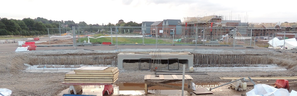 L623 -
First access to St John's Grange development.
L623 -
First access to St John's Grange development.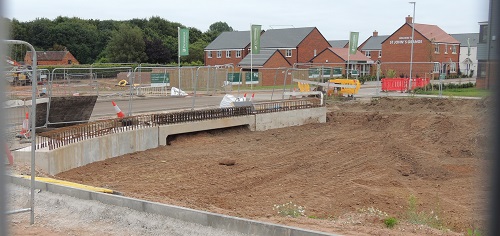 L640 -
Second access to St John's Grange development.
L640 -
Second access to St John's Grange development.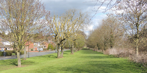 L650 The old and
new routes re-join after Lock 22 (old route) and
L650 The old and
new routes re-join after Lock 22 (old route) and 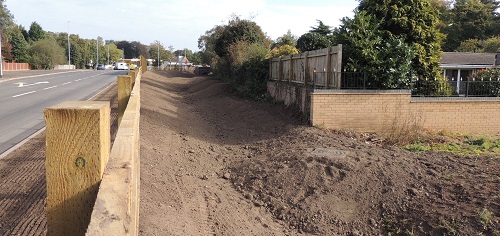
 L660 The
"pinch point"
L660 The
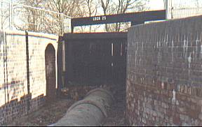
"pinch point" L670 Lock
23
L670 Lock
23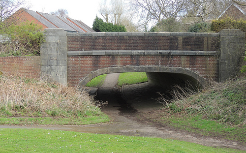
 L717 -
Longbridge Lift-bridge at Gallows Reach
L717 -
Longbridge Lift-bridge at Gallows Reach L720 -
Narrow boat Rose Willow
L720 -
Narrow boat Rose Willow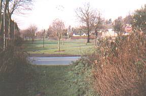
 L730 -
Cricket Lane (Ryknild Street Roman road) was
crossed and old lock 24 was a little distance to the east.
L730 -
Cricket Lane (Ryknild Street Roman road) was
crossed and old lock 24 was a little distance to the east.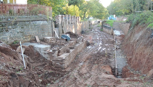
 L790 -
Lichfield Canal Pound 27 and "Bobbie's bend"
L790 -
Lichfield Canal Pound 27 and "Bobbie's bend"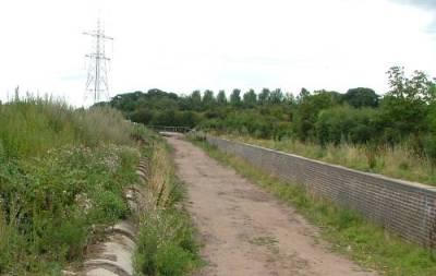
 L830 -
narrows & winding hole
L830 -
narrows & winding hole 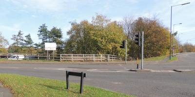 Tamworth
Road (A51) - will be crossed just before the A38
as the canal turns to the north-east.
Tamworth
Road (A51) - will be crossed just before the A38
as the canal turns to the north-east.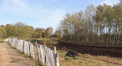 L860 -
Darnford Park, Ryknild Street
L860 -
Darnford Park, Ryknild Street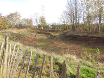 A38 - will be crossed via a tunnel
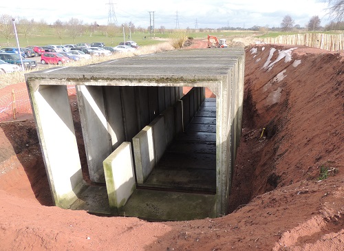 L940 -
Darnford Lane Bridge.
L940 -
Darnford Lane Bridge. 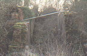 L950 - Old
Lock 29
L950 - Old
Lock 29 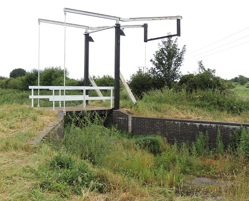 L960 -
Darnford Lift Bridge
L960 -
Darnford Lift Bridge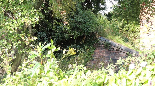
 L990 -
Cappers Bridge, Capper's Lane
L990 -
Cappers Bridge, Capper's Lane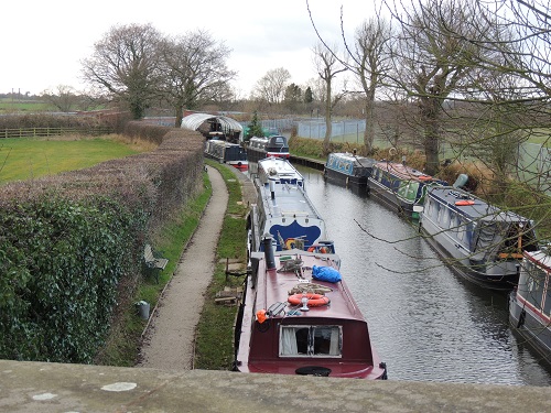 L990 -
East of Capper's Lane
L990 -
East of Capper's Lane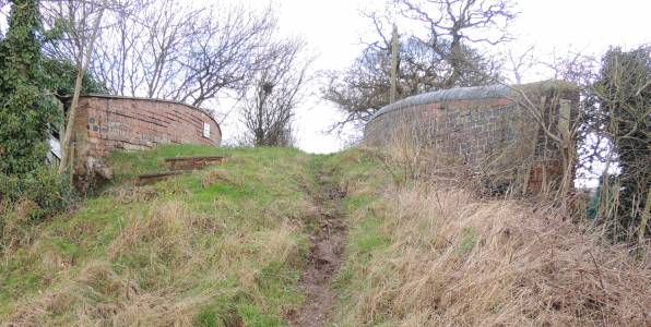
 LC1000 -
Watery Lane Bridge
LC1000 -
Watery Lane Bridge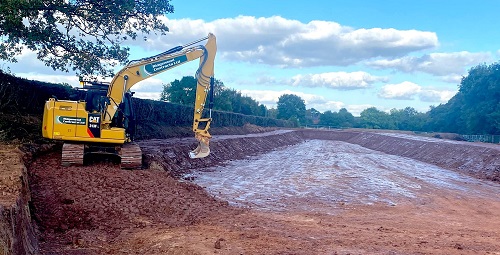
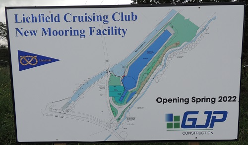 LC1010 -
Lichfield Cruising Club new Moorings
LC1010 -
Lichfield Cruising Club new Moorings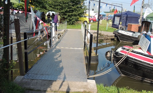 LC1030 - LCC Sliding Bridge
 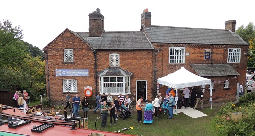 LC1050 -
Canal Cottages, Huddlesford
LC1050 -
Canal Cottages, Huddlesford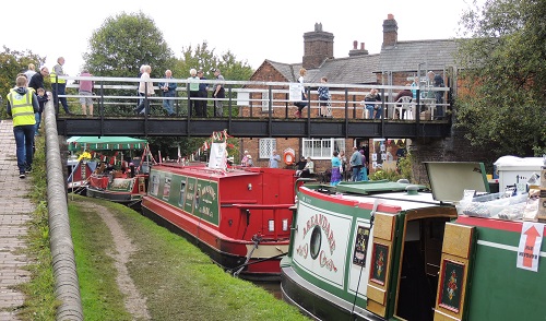
 LC1060 -
Huddlesford Junction (with the Coventry Canal)
LC1060 -
Huddlesford Junction (with the Coventry Canal)