Virtual
Walks-6 The Cannock Extension from Pelsall Junction
(May 2003 onward)
Wyrley and Essington Canal |
| Visit the Lichfield & Hatherton Canals
Restoration Trust web site to find out about the Trust that was
formed in 1988 and is a registered charity. It campaigns
for the restoration of the "Lichfield
Canal" (as the closed section of the W&E between
Ogley and Huddlesford is now called) and also the
Hatherton Canal through the Cannock / A5 area. It
promotes the restoration as public amenities for boating,
angling, walking, cycling etc. and raises funds to carry
out physical restoration work. |
I
have been greatly helped in this "Virtual Walk"
by the National Library of Scotland who offer "This
application that allows a set of historical map
overlays to be viewed (against current maps)".
Without this impressive research tool identifying long
lost routes is unreliable or almost impossible.
I
have been able to check some of the pointers used below
but there are many that are imposible to check and may be
inacurate!
|
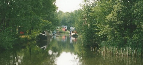
 CE020
Pelsall Junction - 12
miles 7¼ furlongs from Horseley Fields Junction,
Wolverhampton. CE020
Pelsall Junction - 12
miles 7¼ furlongs from Horseley Fields Junction,
Wolverhampton.
(https://www.google.co.uk/maps pointer ---- 52.6377, -1.9726)Left
towards Wolverhampton. ( See Virtual Walks-7 )
Straight ahead over the footbridge to the Cannock
Extension branch.
Right towards
Brownhills. ( See Virtual Walks-3).
https://www.openstreetmap.org/?mlat=52.63770&mlon=-1.97259#map=18/52.63769/-1.97259
|
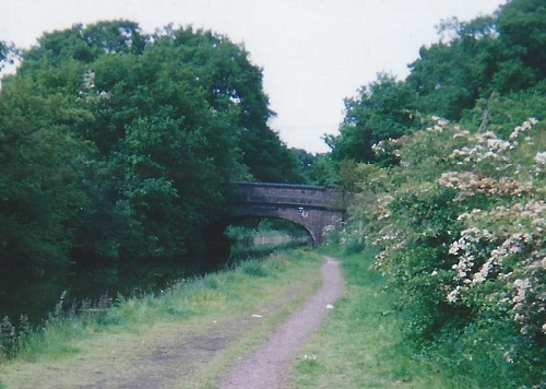
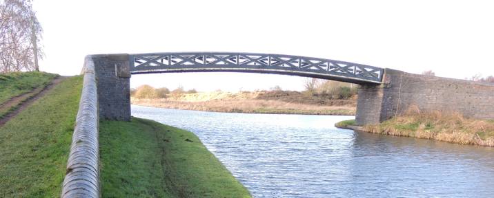 CE020
Pelsall Junction Bridge footbridge CE020
Pelsall Junction Bridge footbridge taken looking West - 17/1/2014.
https://www.openstreetmap.org/?mlat=52.63768&mlon=-1.97224#map=18/52.63769/-1.97224
Access from Pelsall via Nest Common on the left.
Access from the Cannock Extension Canal and
Pelsall North Common
over the footbridge to the right.
|
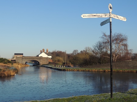
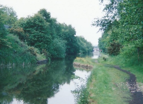
 CE030
Friar Bridge - at the start of Cannock Extension
branch. CE030
Friar Bridge - at the start of Cannock Extension
branch.½ furlong from Pelsall Junction
(https://www.google.co.uk/maps pointer ---- 52.6383, -1.9726)
https://www.openstreetmap.org/?mlat=52.63838&mlon=-1.97263#map=18/52.63838/-1.97263
Taken looking North from Pelsall Junction - 17/1/2014.
Access from Pelsall North Common.
Access from Pelsall via Nest Common and over the
footbridge out of shot on the right.
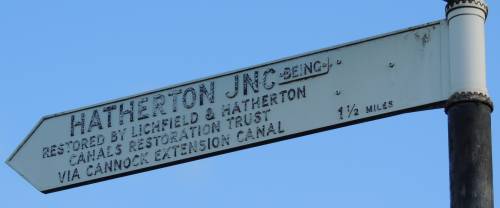
The sign indicates what was the plan for connecting a
restored Hatherton Branch Canal to the W&E via the
Cannock Extension branch. Due to various problems the
LHCRT now plan that a connection to the W&E will be a
little farther along the route to Wolverhampton.
See Virtual Walks-7
Pelsall Junction to Lord Hayes Branch for more details.
|
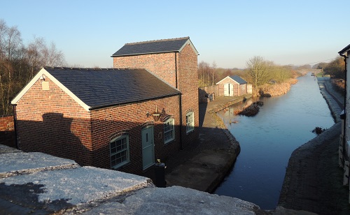 |
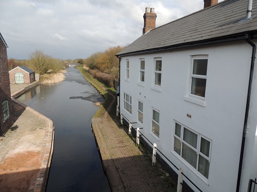
CE030 - buildings north
of Friar Bridge (Pelsall Stop) To
the left
Pelsall Stop Cottage
https://www.openstreetmap.org/?mlat=52.63854&mlon=-1.97273#map=18/52.63854/-1.97272
To the right
The two cottages at Pelsall Stop now numbered BCN211
and BCN212
https://www.openstreetmap.org/?mlat=52.63855&mlon=-1.97244#map=18/52.63855/-1.97245
|
 |
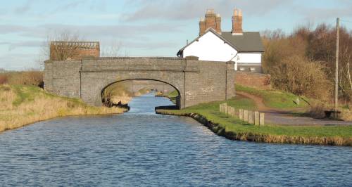
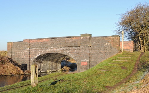 CE040
Pelsall Common Bridge CE040
Pelsall Common BridgePelsall Common Bridge
– looking north
1¾ furlongs from Pelsall Junction
https://www.openstreetmap.org/?mlat=52.64042&mlon=-1.97253#map=18/52.64042/-1.97253
(https://www.google.co.uk/maps pointer ---- 52.6404, -1.9725)
Taken looking North.
Access from Pelsall North Common.
|
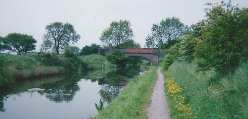 CE050
Green Bridge CE050
Green Bridge3¼ furlongs from Pelsall
Junction
https://www.openstreetmap.org/?mlat=52.64257&mlon=-1.97243#map=18/52.64256/-1.97242
(https://www.google.co.uk/maps pointer ---- 52.6425, -1.9724)
Taken looking North.
Access to and from farmer's fields only.
|
| CE070 Wyrley Grove Wharf 5¼
furlongs from Pelsall Junction
|
 CE070
Wyrley Grove Bridge (or Wyrley Lane Bridge) CE070
Wyrley Grove Bridge (or Wyrley Lane Bridge)5¾
furlongs from Pelsall Junction
https://www.openstreetmap.org/?mlat=52.64630&mlon=-1.97226#map=18/52.64630/-1.97225
(https://www.google.co.uk/maps pointer ---- 52.6462, -1.9722)
Taken looking North.
Access from Wyrley Lane.
|
 CE080
Wyrley Common Bridge The canal narrows where a
railway bridge passed over the canal. CE080
Wyrley Common Bridge The canal narrows where a
railway bridge passed over the canal.
The mineral railway to Wyrley Common Pit ran to the
right (east) and to Grove
Collery and wharfs to the left (west).
1 mile and 1¼ furlongs from Pelsall
Junction
https://www.openstreetmap.org/?mlat=52.65153&mlon=-1.97202#map=18/52.65153/-1.97202
(https://www.google.co.uk/maps pointer ---- 52.6515, -1.9720)
Taken looking North.
Access from public footpath to Lime Lane.
|
 CE90 Grove Collery Wharfs (or Grove Basins) ---- For Brownhills
Colliery Grove Pit (Wyrley Grove Colliery). CE90 Grove Collery Wharfs (or Grove Basins) ---- For Brownhills
Colliery Grove Pit (Wyrley Grove Colliery).
Taken looking West.This was intended to be
the start of the new route to the Hatherton Branch of the
Staffs and Worcester, replacing the lost section that is
described below. The early part of the new canal would
have followed the line of the old tramway that delivered
cable pulled coal tubs to the canal wharf.
The Hatherton Canal is now expected to
join the W&E via the Lords Hays Branch west of
Pelsall Junction. See Virtual
Walks-7 Pelsall Junction to Lord Hayes
Branch for more details.
1 mile 1½ furlongs from Pelsall
Junction
https://www.openstreetmap.org/?mlat=52.65204&mlon=-1.97206#map=18/52.65203/-1.97206
(https://www.google.co.uk/maps pointer ---- 52.6521, -1.9721)
|
| Visit the Lichfield & Hatherton Canals
Restoration Trust web site to find out about the Trust that was
formed in 1988 and is a registered charity. It campaigns
for the restoration of the Hatherton
Canal from the Wyrley and
Essington, through the Cannock / A5 area to meet the Staffordshire
and Worcestershire Canal at
Hatherton Junction, Calf
Heath. It promotes the restoration as
public amenities for boating, angling, walking, cycling
etc. and raises funds to carry out physical restoration
work. |
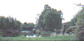
  CE090
Grove Collery
Basins. CE090
Grove Collery
Basins.Taken looking West.
on the left the south basin
on the right the north basin
1 mile 1½ furlongs from Pelsall
Junction
https://www.openstreetmap.org/?mlat=52.65204&mlon=-1.97206#map=18/52.65203/-1.97206
(https://www.google.co.uk/maps pointer ---- 52.6521, -1.9721)
|
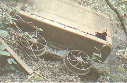 CE095 Grove Collery tramway from Brownhills
No.3 Colliery CE095 Grove Collery tramway from Brownhills
No.3 Colliery Further to the west --- Brownhills No.3
Colliery (Wyrley No.3) (also "Harrison's" or
"Sinking" or No.3 Plant)
This pit was connected to basins via cable tramway.
The cableway ran from the basins along a dead straight
line. Trees or overgrown hedging can still be seen along
part of the route.
Grove Collery - https://www.openstreetmap.org/?mlat=52.65362&mlon=-1.97378#map=17/52.65362/-1.97378
Brownhills No.3 Colliery - https://www.openstreetmap.org/?mlat=52.65861&mlon=-2.00237#map=17/52.65861/-2.00237
Taken to the west of the basins - May 1990.
------ (More Photos in my Flickr
album - Cannock Extension Canal)
|
CE100 Pelsall Road Bridge (the
old bridge)
1 mile 3 furlongs from Pelsall Junction
https://www.openstreetmap.org/?mlat=52.65407&mlon=-1.97182#map=17/52.65407/-1.97182
(https://www.google.co.uk/maps pointer ---- 52.6541, -1.9718) (photo taken 2/6/2007)
Taken looking back South.
Access from Lime Lane.
|
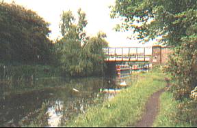 The old
bridge (taken 2003).
Taken looking North.
Access from Lime Lane.
|
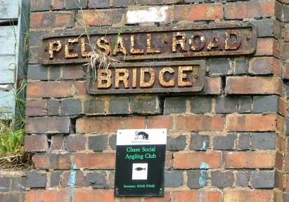 The old bridge sign.
Taken looking North - photo 2/6/2007
|
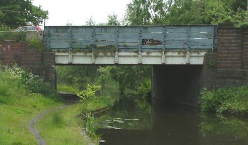
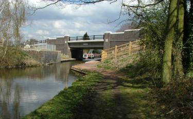 CE110 Pelsall Road Bridge (the new bridge) CE110 Pelsall Road Bridge (the new bridge)
The new bridge dated 2008 with the remaining brickwork
of the old bridge in front of it (taken 1/4/2009).
https://www.openstreetmap.org/?mlat=52.65435&mlon=-1.97179#map=17/52.65435/-1.97179
(https://www.google.co.uk/maps pointer ---- 52.6544, -1.9719)
Taken looking North.
Access from Lime Lane.
|
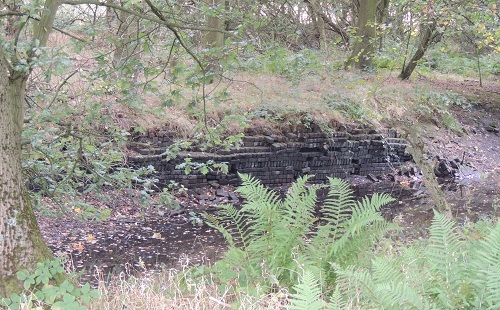 CE120
Norton Common Basin ? For Conduit No.1 pit via
tramway CE120
Norton Common Basin ? For Conduit No.1 pit via
tramway
1 mile 5 furlongs from Pelsall Junction.Hidden
in the undergrowth beside the towpath.
https://www.openstreetmap.org/?mlat=52.65659&mlon=-1.97153#map=17/52.65659/-1.97153
https://www.google.co.uk/maps pointer ---- 52.6566, -1.9715)
|
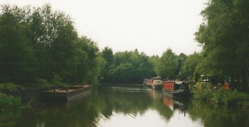
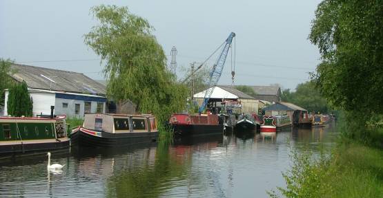 CE130 Norton Canes Docks CE130 Norton Canes Docks1
mile 5½ furlongs from Pelsall Junction.
https://www.openstreetmap.org/?mlat=52.65747&mlon=-1.97213#map=17/52.65747/-1.97213
https://www.google.co.uk/maps pointer ---- 52.6581, -1.9716)
Yates Brothers Boatyard - The site of the Yates canal empire
that once consisted of a fleet of 400 boats. The site is
now occupied by Norton Canes Boatbuilders and Denis
Cooper's Canal Transport Services boat yard.
In 1982 the boatyard of M.E. Braine Boatbuilders Ltd.
on this stretch of the canal was used to film the BBC
Play For Today “Atlantis”. The comedy drama,
staring Frank Middlemass, was transmitted on 4 January
1983. It was about the conversion of an old narrow boat
into a pleasure cruiser. The show ended with a sting in
the tail when the boat started its first trip but did not
get very far. Peter Terson (pseudonym of Peter
Patterson) had written the play while he was living
on a boat here.
Does anyone remember the programme or Peter when he lived
on the water here?
Viewed from tow path opposite (Access to boat yard
premises from Lime Lane, near
Yates Sports & Social Club) - photo taken 2/6/2007.
|
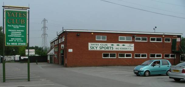 CE140
Yates Sports & Social Club CE140
Yates Sports & Social Clubhttps://www.openstreetmap.org/?mlat=52.65858&mlon=-1.97284#map=17/52.65858/-1.97283
(https://www.google.co.uk/maps pointer ---- 52.6586, -1.9728)
- a reminder of the site of the
Yates canal empire.
(2021 - now closed down?)
Access from Lime Lane - no access to the canal tow
path at this site.
photo taken 2/6/2007
|
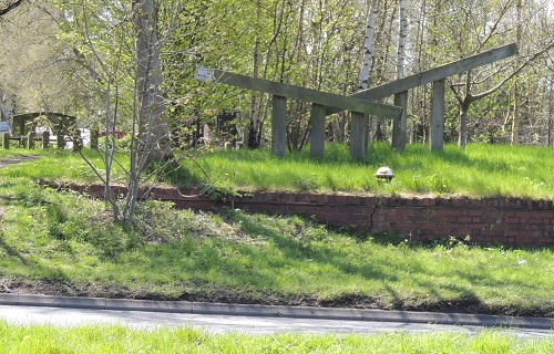 CE150
Watling Street Bridge (A5) CE150
Watling Street Bridge (A5)A representation of
lock gates and a tying up bollard.
To the left is a bench carved in the shape of a canal
bridge and look back up the dead straight canal.
https://www.openstreetmap.org/?mlat=52.65985&mlon=-1.97155#map=17/52.65985/-1.97156
(https://www.google.co.uk/maps pointer ---- 52.6600, -1.9714)
Taken looking south.
Access from Watling Street.
|
| The majority of the rest of the original
canal has disappeared underneath infilling, housing,
industrial development and the new M6 Toll motorway. Coal
was the main load carried by the canal, but eventually
subsidence due to deep coal mining and a large area of
opencast coal mining obliterated most of the line. The
rest of the line took the following route........ |
Warning!
- This route has been long derelict.
Remember that this route should not be thought of as a
public right of way.
Most importantly, note that breaking a leg in
the middle of nowhere is hazardous to health. |
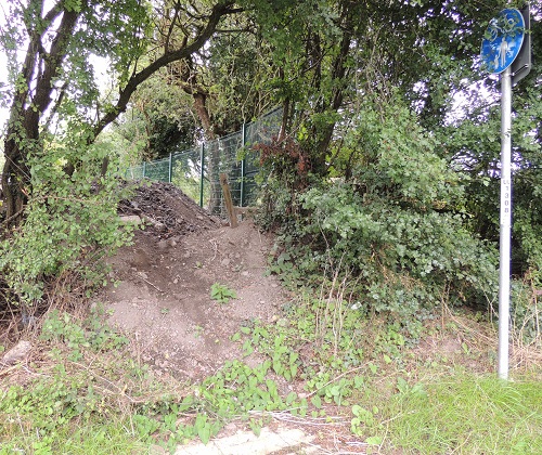 CE155
Watling Street (A5) north side CE155
Watling Street (A5) north sideThe local
authority has confirmed its ownership of the footpath
along the route of the disused Cannock Extension Canal
from the A5 to the M6toll.
It may currently be fenced off and impassable due to
its overgrown condition?
https://www.openstreetmap.org/?mlat=52.66011&mlon=-1.97147#map=17/52.66011/-1.97146
|
CE160 Norton Basin ? A small basin beside A5 Watling Street (east
toward Blacksmiths / Moss's Farm)
(https://www.google.co.uk/maps pointer ---- 52.6601, -1.9713) |
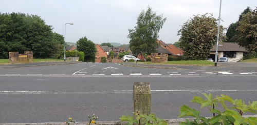
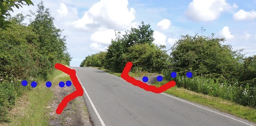
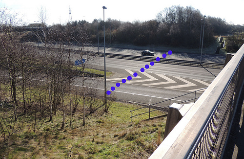 CE170
Norton Green Bridge or Nortongreen Bridge CE170
Norton Green Bridge or Nortongreen BridgeThe
line of the canal from the A5 Watling Street runs from
top right to bottom left.
The canal would have passed under Norton Green Bridge
or Nortongreen Bridge (now the west bound carriageway of
the M6Toll) which took Albutts Road/Commonside over the
canal.
https://www.openstreetmap.org/?mlat=52.66255&mlon=-1.97133#map=17/52.66255/-1.97132
(https://www.google.co.uk/maps pointer ---- 52.6625, -1.9714)
Photo taken from Walsall
Road – looking south towards
the A5 Watling Street.
- 24/2/2016.
------ (More Photos in my Flickr
album - Cannock Extension Canal)
|
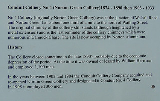
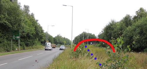
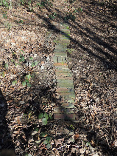 CE180
Norton Green Wharf ? CE180
Norton Green Wharf ?
https://www.openstreetmap.org/?mlat=52.66437&mlon=-1.97132#map=17/52.66437/-1.97132
(https://www.google.co.uk/maps pointer ---- 52.6642, -1.9715) Was there a wharf here - or does "Norton
Green Wharf" refer to the point after BCN House No.213
(see below) where the canal passes north of Conduit No.4
Colliery (Norton Green Colliery)?
At various places the brickwork of the towpath edge
can still be seen.
To walk along the route of the canal use the public
footpath from Walsall Road beside the toll road.
NOTE – walking to Walsall Road may not be
possible and the first part of the public footpath may
require forcing through the encroaching brambles!
Once back on the line of the canal the going is easier.
Photo taken looking north
along the line of the canal from the M6Toll to Bettys
Lane. - 24/2/2016.
------ (More Photos in my Flickr
album - Cannock Extension Canal)
|
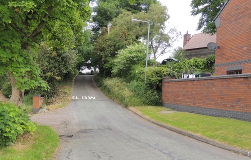
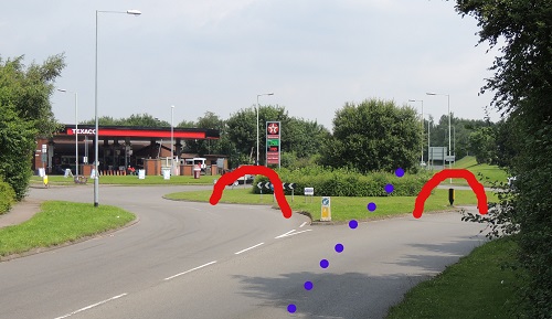
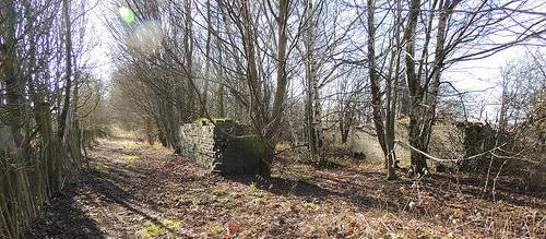 CE190
New Road Bridge CE190
New Road Bridgehttps://www.openstreetmap.org/?mlat=52.66485&mlon=-1.97136#map=17/52.66484/-1.97135
(https://www.google.co.uk/maps pointer ---- 52.6647, -1.9713)
The remains of the abutments of New Road Bridge that
passed over the canal.
The bridge took a track south-east to meet Albutts Road/Commonside.
Photo taken looking south
- back along the line of the canal from Bettys Lane to
the M6Toll. - 24/2/2016.
------ (More Photos in my Flickr
album - Cannock Extension Canal)
|
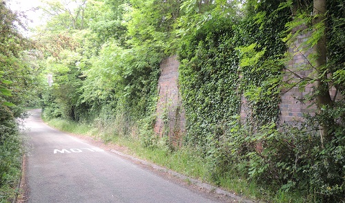
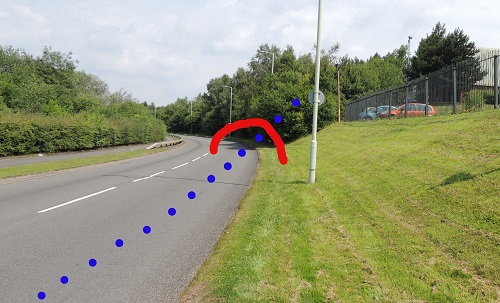
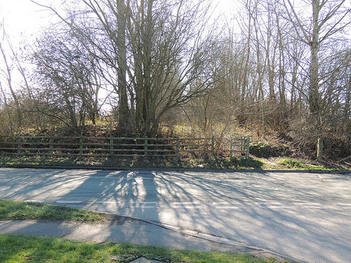 CE200
Foredrove Bridge CE200
Foredrove BridgeWhere the canal
crossed under Betty's Lane on to Red Lion Lane (or
Red Lion Road as it was once called)
https://www.openstreetmap.org/?mlat=52.66645&mlon=-1.97125#map=17/52.66645/-1.97126
(https://www.google.co.uk/maps pointer ---- 52.6664, -1.9712)
Photo taken looking
back south from Conduit Road where Bettys Lane (running
from left to right) was taken over the canal by Foredrove
Bridge. - 24/2/2016.
------ (More Photos in my Flickr
album - Cannock Extension Canal)
|
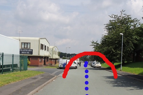
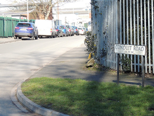 CE210
Norton Springs Branch to Norton Springs Basin (north) CE210
Norton Springs Branch to Norton Springs Basin (north)https://www.openstreetmap.org/?mlat=52.66726&mlon=-1.97140#map=17/52.66725/-1.97140
(https://www.google.co.uk/maps pointer ---- 52.6668, -1.9706)
Level with the first car the canal was crossed by a
railway line running north-west (to the left) and almost
immediately after the canal also veered off to the north-west
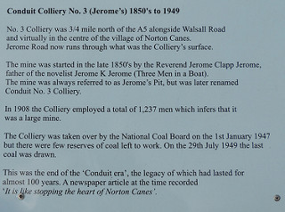
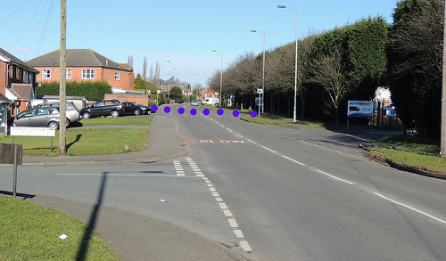
Conduit Road – named after Conduit No.3 Colliery
(Jerome's) that lay at the end of the road and was served
by canal basins that ran along the line of the right-hand
side of the road for three quarters of its length.
Photo taken looking
north along Conduit Road from Bettys Lane (running from
left to right) - 24/2/2016.
------ (More Photos in my Flickr
album - Cannock Extension Canal)
|
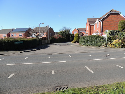
 CE210
Norton Springs Branch to Norton Springs Basin (north) CE210
Norton Springs Branch to Norton Springs Basin (north)
(https://www.google.co.uk/maps pointer ---- 52.6668, -1.9706) North
of the basins was Conduit No.3 Colliery (Jerome's)
At the junction of Brownhills Road and Burntwood Road,
Norton Canes is a small park with some reminders of the
mining history of the area.
for Conduit No.4 Colliery (Norton Green Colliery) and
Conduit No.3 Colliery (Jerome's)
Park location ---- https://www.openstreetmap.org/?mlat=52.67489&mlon=-1.97097#map=17/52.67490/-1.97096
(www.google.co.uk/maps
pointer ---- 52.674726, -1.970966)
Photo taken - 9/2/2016.
------ (More Photos in my Flickr
album - Cannock Extension Canal)
|
CE220 Norton Branch
Railway (LNWR) - crossed
over the canal.
https://www.openstreetmap.org/?mlat=52.66720&mlon=-1.97172#map=17/52.66720/-1.97171
(https://www.google.co.uk/maps pointer ---- 52.6673, -1.9714) |
 CE230
Hednesford Road Bridge - took Hednesford Road over the canal (now
Walsall Road B4154) CE230
Hednesford Road Bridge - took Hednesford Road over the canal (now
Walsall Road B4154)https://www.openstreetmap.org/?mlat=52.66898&mlon=-1.97407#map=17/52.66898/-1.97407
(https://www.google.co.uk/maps pointer ---- 52.6687, -1.9741)
The canal crossed from right to left under Hednesford
Road Bridge and running north-west, followed the line of
Mere Croft (off Norton Grange).
Just beyond the site of the crossing is Lock Keepers
Close – the site of BCN house No. 213.
Photo taken looking
north along Walsall Road at its junction with Norton
Grange - 24/2/2016.
------ (More Photos in my Flickr
album - Cannock Extension Canal)
|
Looking west across Walsall Road at its junction with
Lock Keepers Close
Photo taken - 24/2/2016.
------ (More Photos in my Flickr
album - Cannock Extension Canal) |
CE240 BCN House No.213 On
Walsall Road - probably at its junction with the new
development called Lock Keepers Close.
The canal cottage was probably on the site of the
first house on the right.
https://www.openstreetmap.org/?mlat=52.66918&mlon=-1.97426#map=17/52.66918/-1.97425
|
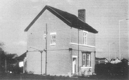
Photo from "The Other Sixty Miles" by Richard
Chester-Browne - published by BCN Society 1981 |
 CE250
Wharf - (see Norton Green
Wharf above ?) CE250
Wharf - (see Norton Green
Wharf above ?)
https://www.openstreetmap.org/?mlat=52.66937&mlon=-1.97596#map=17/52.66937/-1.97597
(https://www.google.co.uk/maps pointer ---- 52.6692, -1.9758) Was there a wharf here - or does "Norton
Green Wharf" refer to a point near New Road Bridge (see
above)?
At the junction of Brownhills Road and Burntwood Road,
Norton Canes is a small park with some reminders of the
mining history of the area.
for Conduit No.4 Colliery (Norton Green Colliery) and
Conduit No.3 Colliery (Jerome's)
Park location ---- (www.google.co.uk/maps
pointer ---- 52.674726, -1.970966)
Photo taken - 9/2/2016.
------ (More Photos in my Flickr
album - Cannock Extension Canal)
|
CE260 Norton Branch
Railway (LNWR) - crossed
over the canal - again.
(https://www.google.co.uk/maps pointer ---- 52.6701, -1.9780) |
 CE270
Norton Common Bridge which took Chapel Street over
the canal. Norton Common Bridge took Church Road/Chapel
Street over canal. CE270
Norton Common Bridge which took Chapel Street over
the canal. Norton Common Bridge took Church Road/Chapel
Street over canal.Looking north-west from Cema Park to
the junction of Chapel Street / Castlecroft.
The site of Norton Common Bridge.
The canal passed under Chapel Street and went straight
ahead along the line of the start of Castlecroft. The
house to the right is “Bridge Cottage 1899”.
https://www.openstreetmap.org/?mlat=52.67043&mlon=-1.97895#map=17/52.67043/-1.97895
(https://www.google.co.uk/maps pointer ---- 52.6704, -1.9791)
|
  CE280
Badger's Bridge CE280
Badger's Bridge At the brow of
the hill the bridge took Stokes Lane over the
canal. (now near Washbrook Lane.)
https://www.openstreetmap.org/?mlat=52.67132&mlon=-1.98257#map=17/52.67131/-1.98258
(https://www.google.co.uk/maps pointer ---- 52.6716, -1.9826)
Following the road around to the left a retaining wall
of the canal is beside Washbrook Lane.
https://www.openstreetmap.org/?mlat=52.67189&mlon=-1.98425#map=17/52.67188/-1.98424
|
| CE290 Wharf -
for tramway north to Coppice Colliery at Five Ways. https://www.openstreetmap.org/?mlat=52.67189&mlon=-1.98425#map=17/52.67188/-1.98424
(https://www.google.co.uk/maps pointer ---- 52.6722, -1.9842)
|
 CE300
Silvester's Bridge which took Norton Lane over the canal. CE300
Silvester's Bridge which took Norton Lane over the canal.Looking
north-west along Norton Lane.
Just before the brow of the hill and probably level
with the gate on the right Silvester's Bridge took the
canal west under Norton Lane to Silvester's Wharf.
https://www.openstreetmap.org/?mlat=52.67359&mlon=-1.99223#map=17/52.67358/-1.99223
(https://www.google.co.uk/maps pointer ---- 52.6736, -1.9923)
|
| CE310 Silvester Wharf 3 mile 1 furlongs from
Pelsall Junction.
(https://www.google.co.uk/maps pointer ---- 52.6736, -1.9942)
|
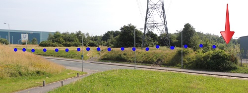 CE320
Kingswood Bridge (or Kings Wood Bridge) CE320
Kingswood Bridge (or Kings Wood Bridge) The
site of Kings Wood Bridge which took a farm track over
the canal (marked with arrow - at the back of the new
unit).
The canal would have run from Kings Wood Bridge from the
right and run on to the left, across the new Cley Road
and on towards Rumer Hill Junction.
https://www.openstreetmap.org/?mlat=52.67420&mlon=-2.00491#map=17/52.67420/-2.00491
(https://www.google.co.uk/maps pointer ---- 52.6740, -2.0051)
|
CE330 Leacroft Wharf and
railway (with tunnel) to Cannock and Leacroft Colliery.
(https://www.google.co.uk/maps pointer ---- 52.6770, -2.0110) |
CE340 High Bridge
took Washbrook Lane (Leacroft) over the canal.
(https://www.google.co.uk/maps pointer ---- 52.6777, -2.0119) |
| CE350 Rummer Hill
Junction with the Churchbridge Branch Canal
leading on to Staffs & Worcestershire Canal link 4
miles 2 furlongs from Pelsall Junction.
https://www.openstreetmap.org/?mlat=52.6783&mlon=-2.0123#map=16/52.6783/-2.0123
(https://www.google.co.uk/maps pointer ---- 52.6784, -2.0125)
See Virtual
Walks-8 Churchbridge Branch Canal for more details.
|
CE360 Rummer Hill
Wharf - now lost under the
A460 Eastern Way
(https://www.google.co.uk/maps pointer ---- 52.6826, -2.0165) |
 CE370
Rummer Hill Bridge CE370
Rummer Hill Bridge At this point the canal
swung from north-west to north-east and now follows the
line of the eastern lane of current A460 Eastern Way dual
carriageway.
Rumer Hill Bridge took York Road over the canal.
The now truncated York Road is to the left of the photo
behind the trees.
https://www.openstreetmap.org/?mlat=52.6830&mlon=-2.0162#map=16/52.6830/-2.0162
(https://www.google.co.uk/maps pointer ---- 52.6831, -2.0163)
|
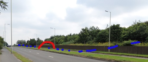
 CE380
Leacroft Bridge took Mill Green over the canal. CE380
Leacroft Bridge took Mill Green over the canal. This
is at the A5190 Lichfield Road / A460 Eastern Way island
with a rough marking of Leacroft Bridge and the line of
the canal towards Hednesford.to the right.
In the corner is the McArthurGlen
Designer Outlet West Midlands shopping complex.
Taken looking ahead west along the A5190 Lichfield
Road towards Cannock.
To the right A460 Eastern Way following the line of the
canal (north) towards Hednesford.
To the left A460 Eastern Way following the line of the
canal (south) towards Rummer Hill Junction.
Behind the camera, the A5190 Lichfield Road runs east
towards Heath Hayes.
https://www.openstreetmap.org/?mlat=52.68615&mlon=-2.01414#map=17/52.68615/-2.01414
(https://www.google.co.uk/maps pointer ---- 52.6861, -2.0142)
|
 CE390 Park
Bridge CE390 Park
Bridge Park Bridge - a footbridge passed over
the canal near Park Farm.
Looking north along the A460 Eastern Way.
The overgrown land to the right of A460 Eastern Way
covers the towpath side of the canal as it runs north
towards Hednesford – now part of a dual carriageway
required for access to Mill Green Outlet Village.
Opened on 12 April 2021 as McArthurGlen
Designer Outlet West Midlands
https://www.openstreetmap.org/?mlat=52.68905&mlon=-2.01299#map=17/52.68905/-2.01299
(https://www.google.co.uk/maps pointer ---- 52.6893, -2.0128)
|
 CE400
Hawkes Green Aqueduct CE400
Hawkes Green Aqueduct Hawkes Green Aqueduct
took the canal over Hawks Green Lane that runs from left
to right.
The lost canal follows the line of current A460 Eastern
Way.
Looking north along the A460 Eastern Way at the junction
with Hawks Green Lane and Hemlock Way.
https://www.openstreetmap.org/?mlat=52.69331&mlon=-2.00967#map=17/52.69331/-2.00967
(https://www.google.co.uk/maps pointer ---- 52.6933, -2.0100)
|
 CE410 Rail
bridge CE410 Rail
bridge LNWR Norton Extension Branch Railway was
carried over the canal
Looking north along the A460 Eastern Way at the point
where the road veers off to the left leaving the line of
the canal that went straight to follow the line of the
current Hyssop Close that is hidden behind the trees.
https://www.openstreetmap.org/?mlat=52.69512&mlon=-2.00864#map=17/52.69512/-2.00864
.
(https://www.google.co.uk/maps pointer ---- 52.6951, -2.0087)
|
 CE420
Hemlocks Bridge CE420
Hemlocks BridgeHemlocks Bridge took a farm
track over the canal.
Looking north where the canal follows the line of the
current Hyssop Close.
https://www.openstreetmap.org/?mlat=52.69692&mlon=-2.00729#map=17/52.69691/-2.00728
(https://www.google.co.uk/maps pointer ---- 52.6957, -2.0075)
|
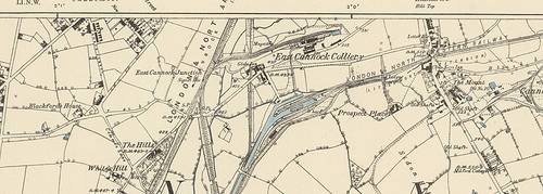 Ordinance
Survey map of the 1880s showing Hednesford Basin, the
Globe Inn and East Cannock Colliery. The "current"
pub "The Globe in Hednesford" has little left
apart from its sign. Ordinance
Survey map of the 1880s showing Hednesford Basin, the
Globe Inn and East Cannock Colliery. The "current"
pub "The Globe in Hednesford" has little left
apart from its sign. a larger map
is available via Flickr.
------ (More Photos in my Flickr
album - Cannock Extension Canal)
|
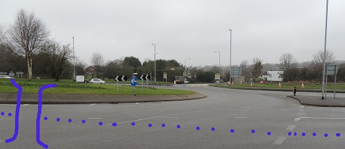
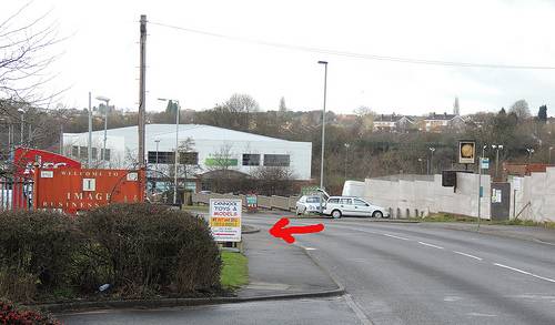 CE430
Tramway north via the Globe to East Cannock Colliery CE430
Tramway north via the Globe to East Cannock Colliery
The footpath leading toward
the site of Hednesford canal basin is on the left (see
red arrow).
To the right are the remains of the Globe pub behind the
pub, farther to the right, was East Cannock Colliery.
Taken from the A460 Old Hednesford
Road – looking towards Cannock. - 10/2/2016.
Location of footpath - https://www.openstreetmap.org/?mlat=52.70031&mlon=-2.00626#map=17/52.70031/-2.00625
(https://www.google.co.uk/maps pointer ---- 52.6976, -2.0071)
Tramway crossing point - https://www.openstreetmap.org/?mlat=52.70031&mlon=-2.00626#map=17/52.70031/-2.00625
------ (More Photos in my Flickr album
- Cannock Extension Canal)
|
| CE440 Hednesford Basin
Wharf (East Cannock Basin) - start of. https://www.openstreetmap.org/?mlat=52.69862&mlon=-2.00580#map=17/52.69862/-2.00581
(https://www.google.co.uk/maps pointer ---- 52.6986, -2.0059)
|
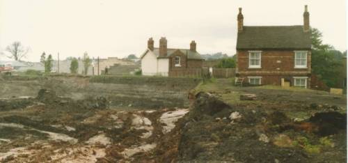 CE450
BCN House No.215 and 216 CE450
BCN House No.215 and 216
May 1984 – the last
days of Hednesford canal basin. I believe the two houses
are BCN Houses No.215 and 216.
In the background to the left are the stepped rooflines
of workshops that still stand in Chaseside Drive.
Taken - May 1984.
https://www.openstreetmap.org/?mlat=52.69926&mlon=-2.00541#map=17/52.69926/-2.00541
(https://www.google.co.uk/maps pointer ---- 52.6991, -2.0057)
------ (More Photos in my Flickr
album - Cannock Extension Canal)
|
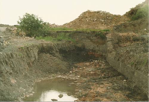 CE460
Hednesford Basin Wharf (East Cannock Basin) - end of. CE460
Hednesford Basin Wharf (East Cannock Basin) - end of.
May 1984 – the last
days of Hednesford canal basin.
Taken - May 1984.
https://www.openstreetmap.org/?mlat=52.69936&mlon=-2.00364#map=17/52.69936/-2.00365
(https://www.google.co.uk/maps pointer ---- 52.6994, -2.0042)
------ (More Photos in my Flickr album
- Cannock Extension Canal)
|
| CE470 Littleworth
Branch Railway (LNWR) running east from the end of basin 5 miles 6 furlongs from
Pelsall Junction.
https://www.openstreetmap.org/?mlat=52.69936&mlon=-2.00364#map=17/52.69936/-2.00365
(https://www.google.co.uk/maps pointer ---- 52.6996, -2.0028)
|
© David Hodgkinson 2000-2021. All rights reserved.